

Borée, Ardèche
Opening : All year round daily.
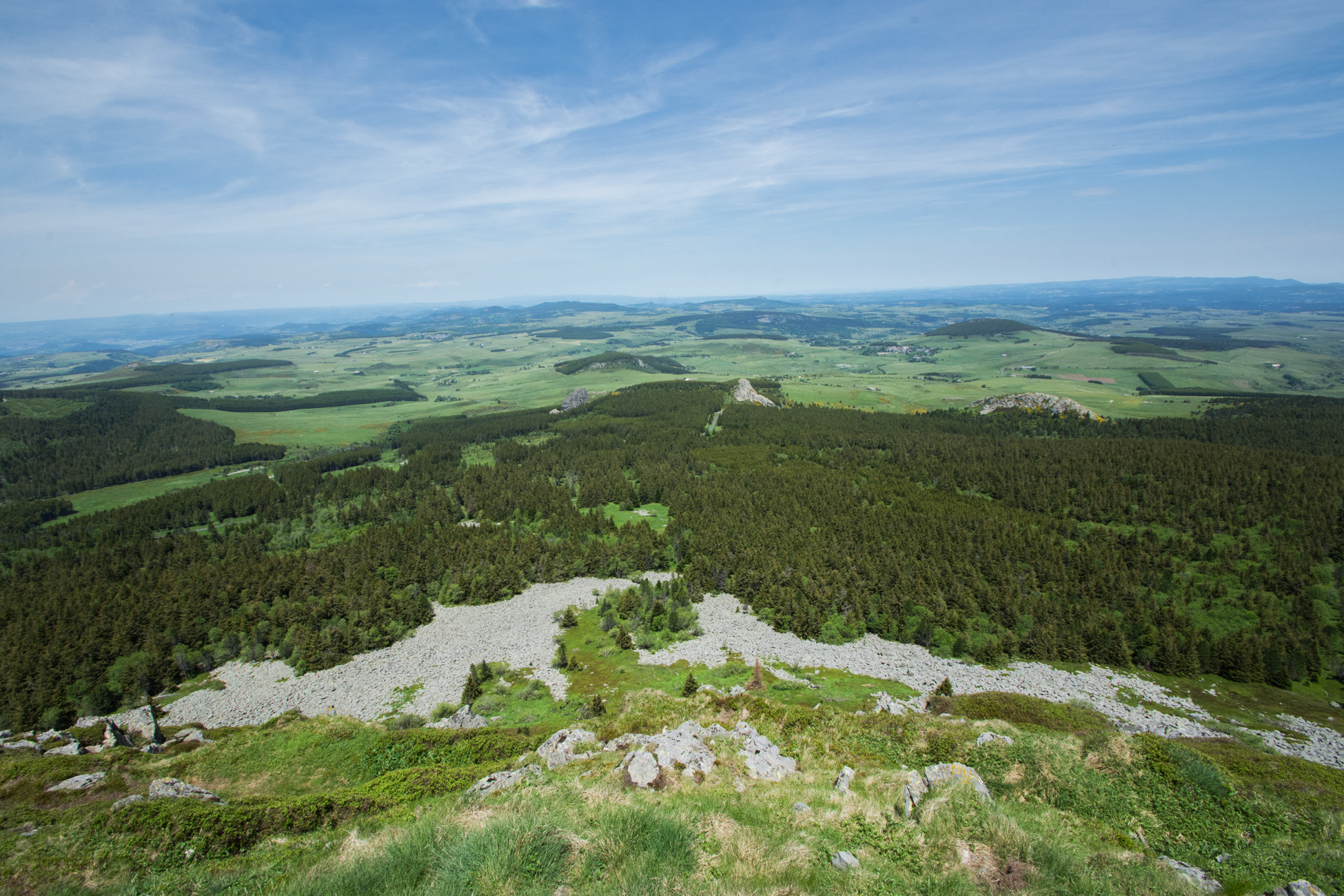
Rising to 1753 m, Mont Mézenc, the highest volcanic summit of the department, marks the watershed between the Atlantic and Mediterranean. A phonolitic dome formed by the coalescence of several lava flows, it offers a 360° panorama.
Regarding Geography and Geology:
Mount Mézenc is located on the border between the Haute-Loire (43) and Ardèche (07) departments, in the heart of the Massif Central, in the eastern Velay region. It is the highest point in both departments and is part of one of Europe’s most unique volcanic complexes. Its dominant position offers an exceptional panorama: to the east, the Rhône Valley and the Alps up to Mont Blanc; to the west, the high plateaus and volcanic massifs of Cantal and Sancy.
Geologically, the Mézenc is a dome volcano formed approximately 7.5 to 8 million years ago. Unlike crater volcanoes, it was built up by the accumulation of very viscous lavas from multiple emission points. These silica-rich lavas produced a specific rock: phonolite, light in color and sonorous, typical of this region. This formation belongs to the last phase of volcanic activity in eastern Velay.
Today, the Mézenc presents a massive and rounded relief, marked by two distinct summits: one at 1753 m on the Ardèche side, the other at 1744 m on the Haute-Loire side. Separated by the watershed and administrative boundary, these two peaks offer complementary views of the surrounding landscapes. The main dome still retains visible lava dykes, witnesses of its complex volcanic past.
Regarding Hiking:
Mount Mézenc, with its characteristic horse-saddle shape, reaches 1753 m in Ardèche, just above the secondary summit in Haute-Loire (1744 m). From the summit, the contrast is striking between the gentle slopes to the north and the steeper terrain to the south, offering an exceptional panorama extending to the Alps and the Massif Central.
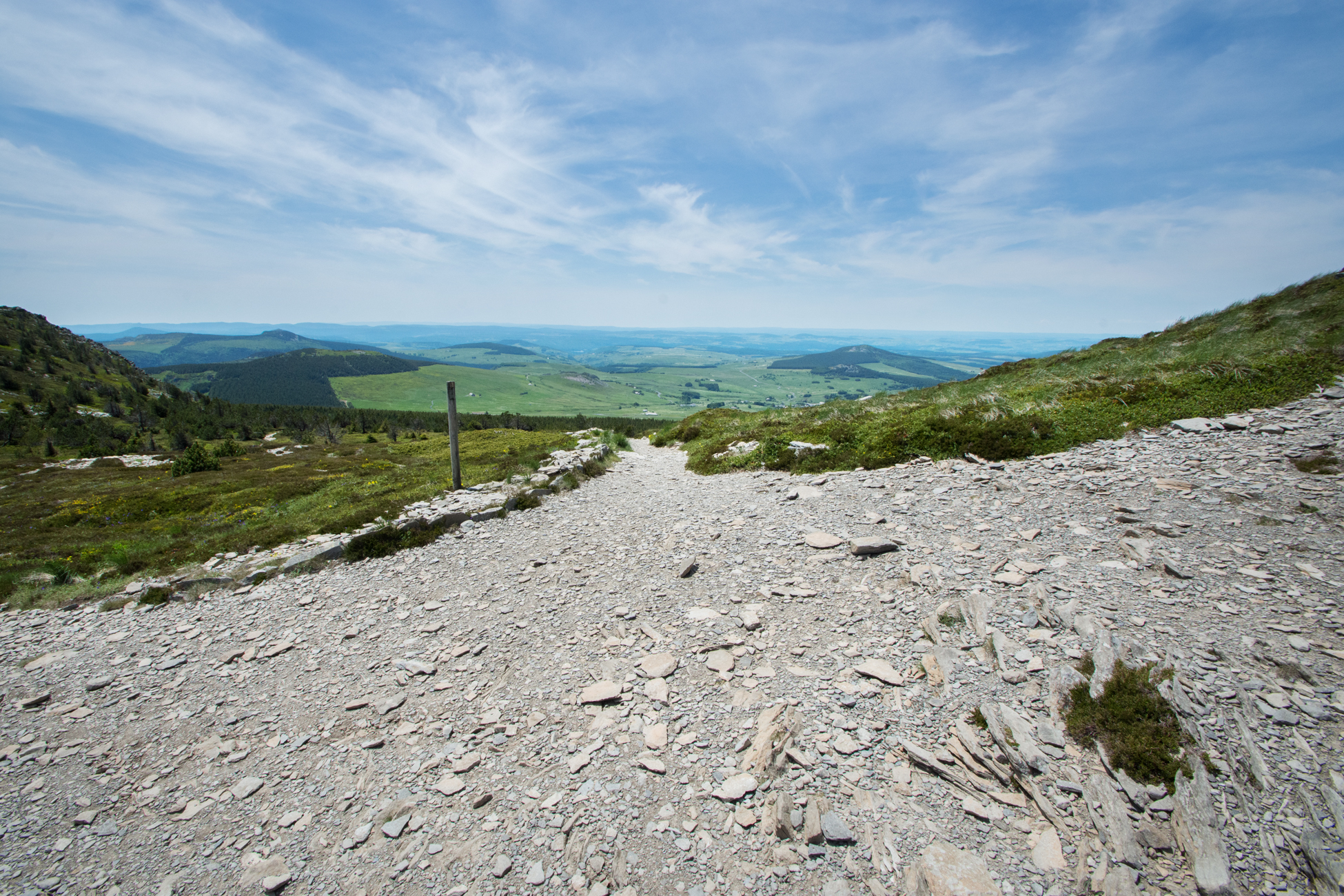
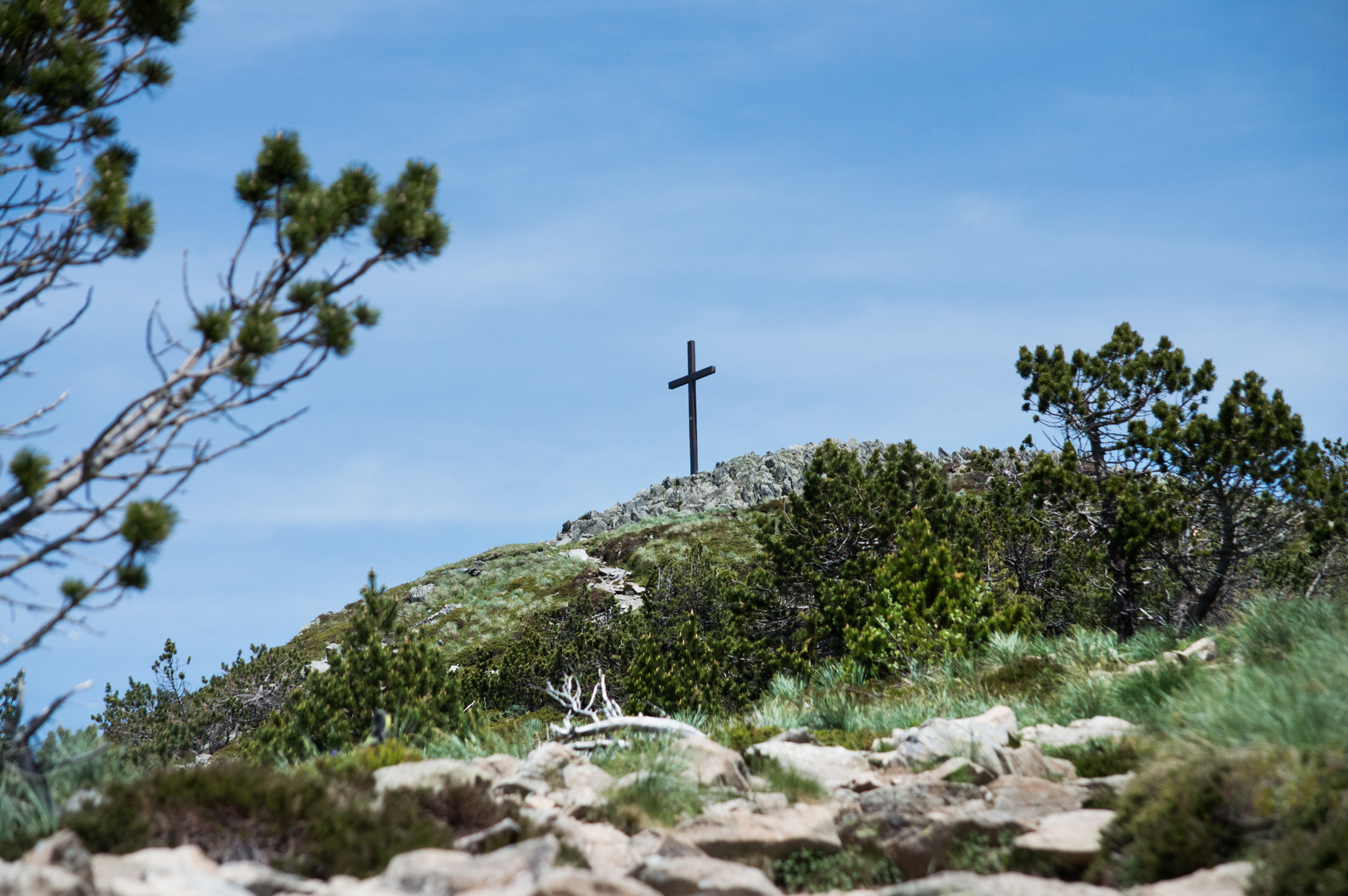
Two main trails allow an easy ascent in about 2 hours round-trip: from the Croix de Boutières (Ardèche) or from the Forest House (north side). These well-marked routes, equipped with low walls and cables, protect the fragile flora and lead to the summit cross where panels explain the geology and ecology of the site. A loop trail of about 2.5 hours is also possible.
For experienced hikers, several long and challenging loops start from the village of Borée, including the Tour du Mézenc (25 km, 7 h) and the Cirque des Boutières circuit (28 km, 8 h). These routes cross varied landscapes from subalpine heathlands to forests, with good chances of spotting marmots, golden eagles, and Apollo butterflies.
- Picnic area
- Orientation board
- Parking
- Coach access
- Tour free of charge
- Pets accepted: Unknown
- Pets allowed (supplementary payment): Unknown


