
A walk starting from the village of Thueyts in the Ardèche, with its Devil's Bridge and King's Ladder.
Opening : All year round.
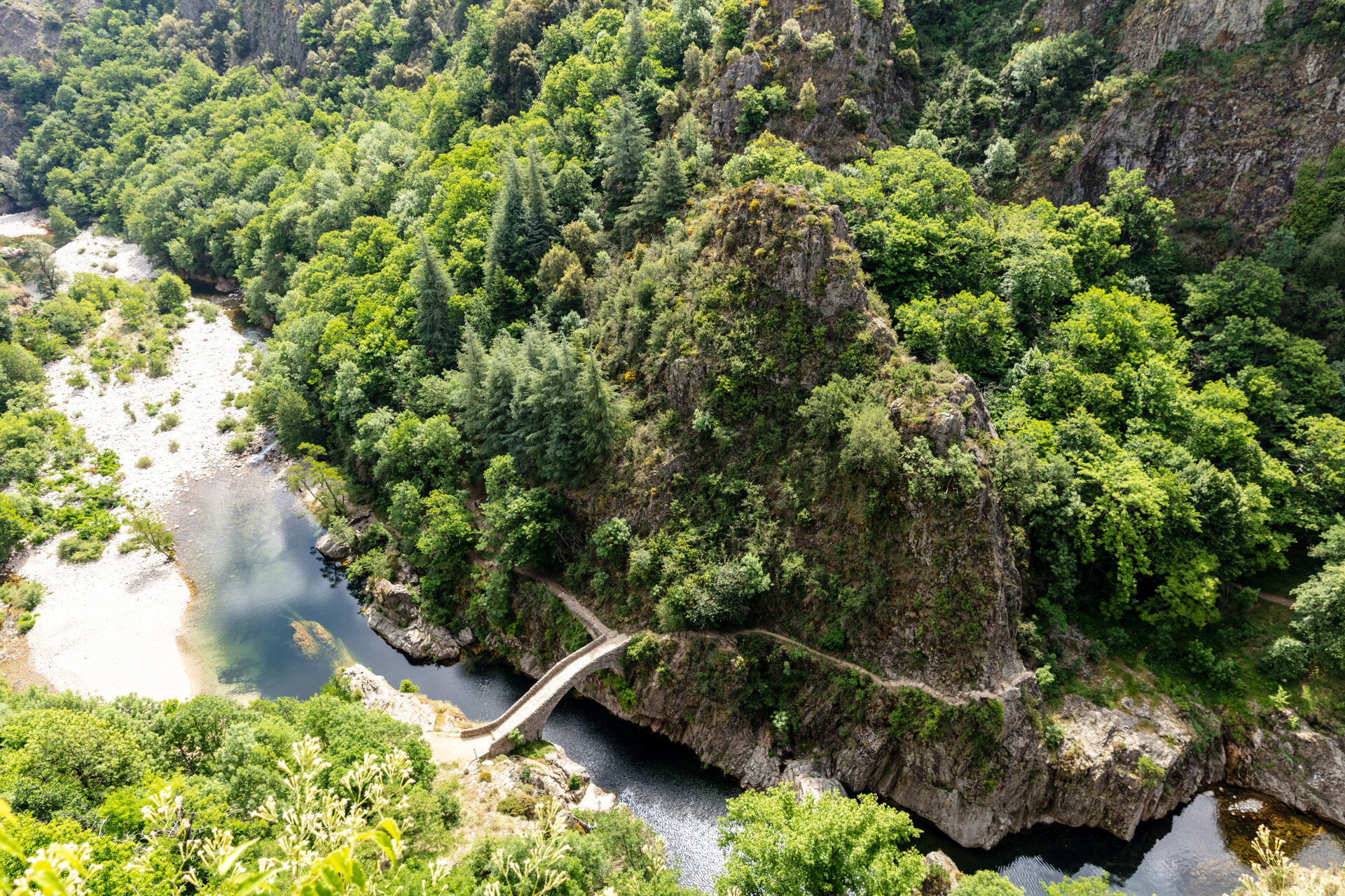
Explore the Devil’s Bridge Valley and its famous king’s ladder! A staircase shaped directly into the volcanic rock that creates an unprecedented passage for a unique ascent to the character village of Thueyts.
An easily accessible walk, from the center of the village of Thueyts, that takes you to discover the basalt flow of the chaussée des géants, the must-see natural site of the Pont du diable, and the échelle du roi (King’s ladder). Download the printable itinerary here
🔁Loop ⚠2 Easy 🕒1H15 📏1.9km 📈+81m ![]() PR
PR
Starting from the “INFO RANDO” sign on the Place du Champ de Mars, in Thueyts.
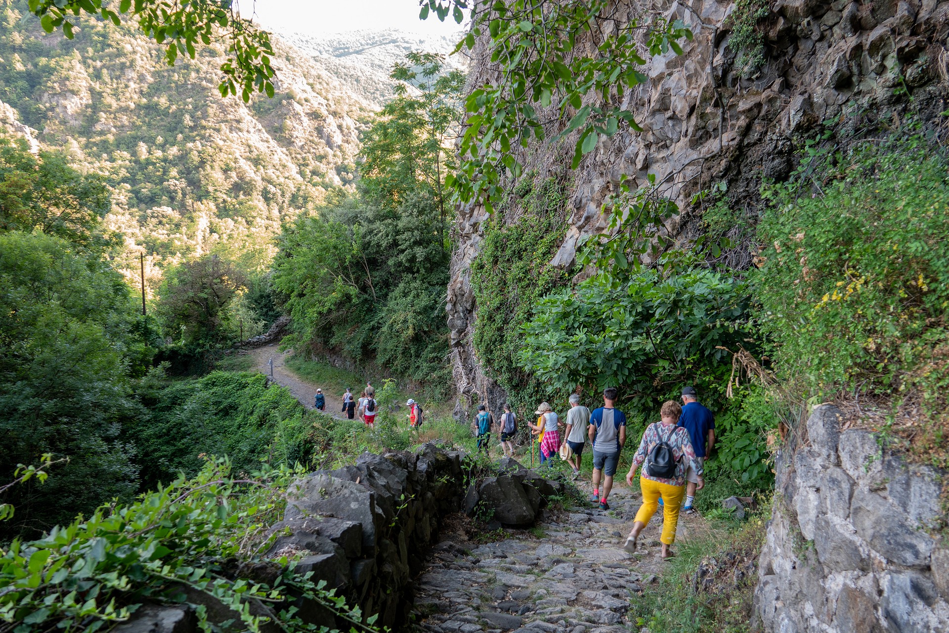
① From the square in Thueyts, go down the N102 (white and yellow markings) towards Aubenas/ Neyrac.
② Just before the bridge, turn left towards via ferrata/ Pont du diable. To enjoy the panorama, you can cross the bridge to admire the Pont du diable site from the belvedere of the gueule d’enfer. Just before the wastewater treatment plant, turn right, go under the bridge, and descend the path that passes under the basalt columns.
③ At the fork, take the right towards “échelle du roi, pont du diable”.
④ At the next fork, take the left towards “Fargebelle 1.8km, Jaujac 9.1km”.
⑤ Once on the road, turn right towards “pont du diable”. At the “Plage publique” sign, turn right onto the road. Pass the reception buildings for the via ferrata and the site, and head towards the stairs facing the Pont du diable.
⑥ Just before the bridge, at the turtle table, take the
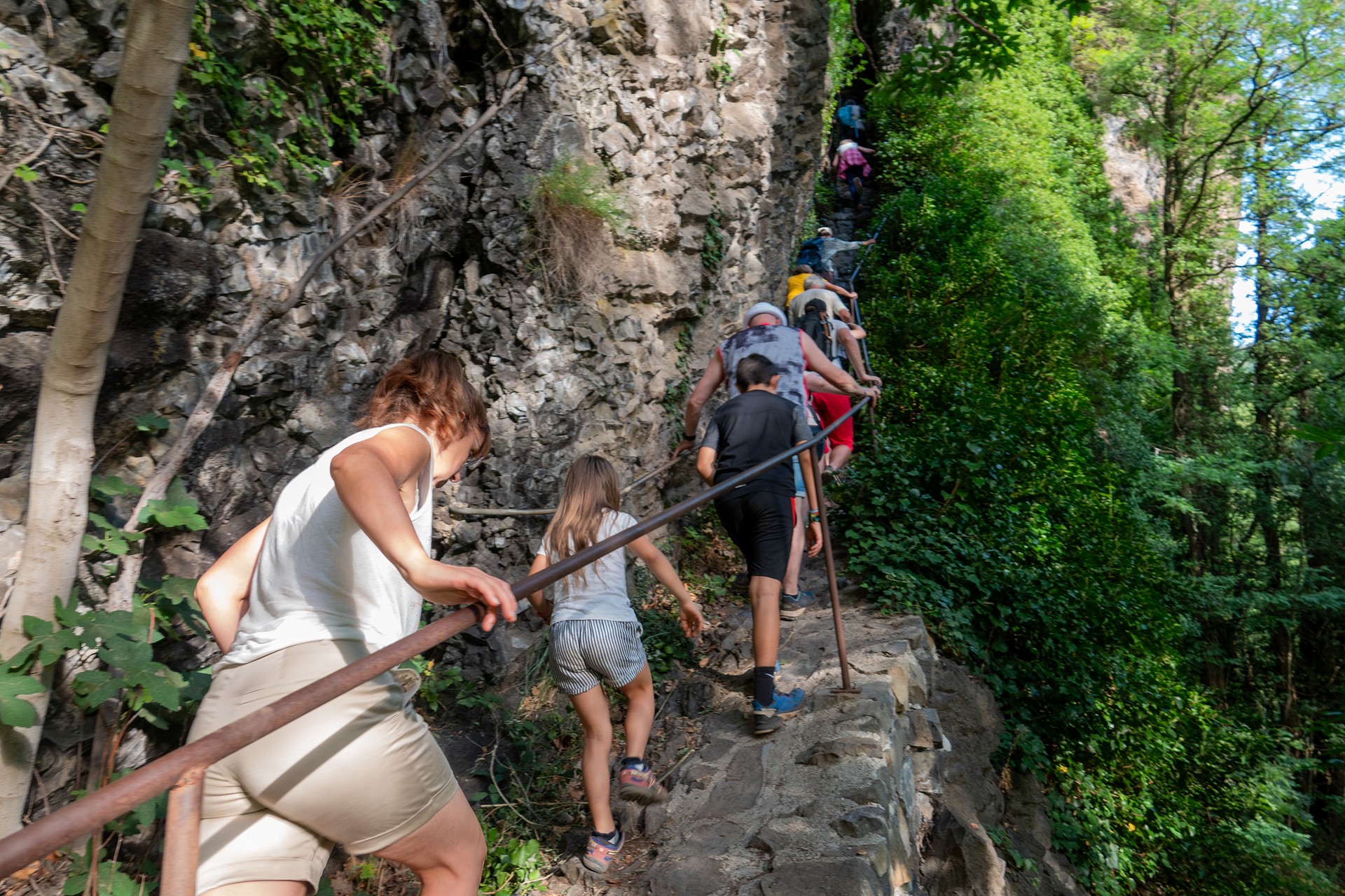
stairs going up to the right indicating “Thueyts by échelle du roi 20min, via ferrata left bank, 5min”. Arriving at the foot of the basalt flow, turn left. Pass the via ferrata and continue straight, along the flow under the impressive columns towering above you. At the corner of the flow, follow “Thueyts, échelle du roi, 0.9km”. You will then arrive at the foot of the grandiose échelle du roi, a staircase carved into the basalt flow. Climb it to reach a first small belvedere, then the stairs space out until you reach a second belvedere marking the top of the flow, overlooking the Ardèche valley.
⑦ At the football field, turn right to follow the valley and then climb the stairs to the top of the hill where an interpretation table explains the flow on which you stand. Before continuing around the football field, don’t miss the panorama of the Pont du diable from the belvedere.
⑧ At the site welcome sign, take the road to the right, returning to the village (Chemin de la Condamine).
⑨ Back on the national road, turn right towards the square, your starting point.
Start/End: Place du Champ de Mars in Thueyts.
Communes crossed: Thueyts.
Road access and parking
From Aubenas, head towards Le Puy en Velay and continue on the N102 to the village of Thueyts.
Parking: Parking in the village square (except on Fridays, market day). Several free parking lots available in the village of Thueyts.
🛈 Find here all the hikes in our area and on the Application Rando Monts d’Ardèche
- Car park
- Parking
- Pets welcome
- Pets accepted: Yes
- Animal reception conditions:
Please keep your pets on a leash during your hikes.
- Not accessible in a wheelchair
- English
- French
Hiking : The Devil's bridge - King's ladder in Thueyts
Place du Champ de Mars
07330 Thueyts


