


Randonnée du village de Péreyres à la cascade du Ray Pic en Ardèche
Opening : All year round.
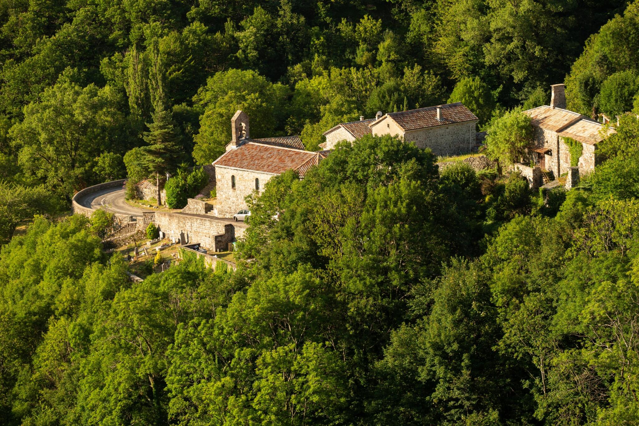
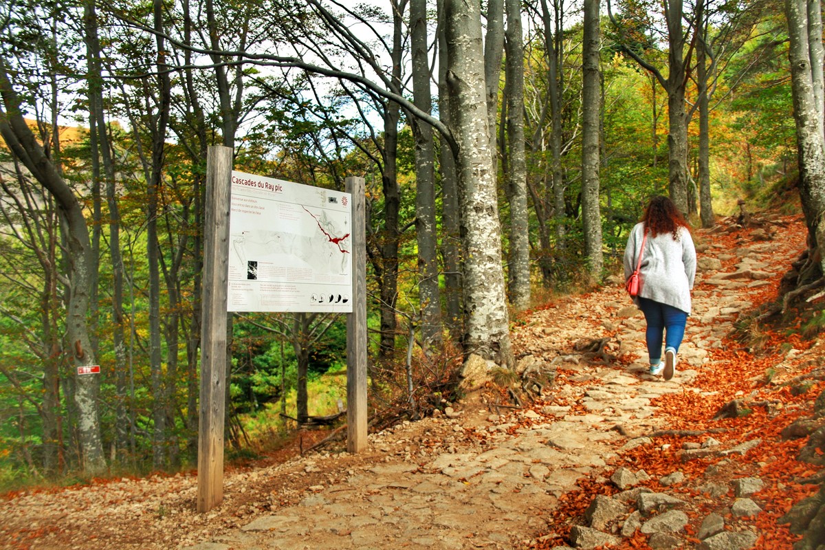
This out-and-back walk in the Péreyres commune takes you to the majestic Ray-Pic waterfall, a must-see volcanic site in the Ardèche! Most of the trail is in woodland, with several steps leading up to it.
From the small village of Péreyres and its houses clinging to the mountain to the Ray-Pic waterfall you will take the GRP of the Haute Cévennes Ardèche. Beyond its beauty, the Ray Pic waterfall is also known as an exceptional volcanic site, classified as a Geosite by UNESCO. The basaltic flow at Ray-Pic extends over 20 kilometres, one of the longest in Europe. It is a small landscaped path that leads you to different wooden terraces overlooking the waterfall. Breathtaking!
Departure/ Arrival: Place du Village
~~~~~~~~~~~~~~~~~~~~~
➤ Departure of the sign «INFO RANDO» place of the village.
Follow the sign Lachamp-Raphaël 8,8km. Climb the calade. Opens to you a superb panorama of the valley of Bourges and a beautiful view overlooking the village of Péreyres.
➤ Merge onto RD 215, turn left to the hamlet of Chabron.
➤ Pass the hamlet and follow direction Poteau Ray-Pic 4km. Continue on RD 215 until the Ray-Pic bridge.
➤ Cross the bridge and take the path on the left that winds through the woods to the Ray-Pic parking lot.
➤ Descend (15mn) by the path through the beech trees and the blueberry moors to the Ray-Pic waterfall. Direct access to the river and swimming are strictly prohibited.
The return to Péreyres is done by the same way.
The loop is marked with yellow and white paint.
Attention swimming at the foot of the Cascade is strictly prohibited.
↔ Aller-retour ⚠3 Moyen 🕒3H 📏5,8km 📈+223m 📉-218m ![]() PR
PR
Départ du panneau « INFO RANDO » place du village de Péreyres.
① 🚩Suivez le panneau Lachamp-Raphaël 8,8km. Montez la calade. S’ouvre à vous un superbe panorama sur la vallée de la Bourges et une belle vue dominante sur le village de Péreyres.
② Rejoignez la RD 215, prenez à gauche jusqu’au hameau du Chabron.
③ Dépassez le hameau et suivez la direction Poteau 🚩 RayPic 4km. Continuez sur la RD 215 jusqu’au pont du Ray-Pic.
④ Franchissez le pont et empruntez le sentier de gauche qui serpente dans les bois jusqu’au parking du Ray-Pic.
⑤ Descendez (15mn) par le sentier à travers les hêtres et les landes à myrtilles jusqu’à la cascade du Ray-Pic. L’accès direct à la rivière et la baignade sont strictement interdits. Le retour à Péreyres s’effectue par le même chemin.
Départ/Arrivée : Place du village à Péreyres
Communes traversées : Péreyres
Accès routiers et parkings
Aubenas, prenez la N102 jusqu’à Pont de Labeaume. A la sortie du village prendre à droite la D536, direction Montpezat sous Bauzon puis la D215 direction St Pierre de Colombier.
Thueyts, prenez la N102, direction Aubenas. Avant l’entrée de Pont de Labeaume, prenez la direction Montpezat-sous-Bauzon puis la D215 direction St Pierre de Colombier.
Stationnement : Dans le village de Péreyres.
🛈 Retrouvez ici toutes les randonnées de notre territoire et sur l’Application Rando Monts d’Ardèche
- Pets welcome
- Pets accepted: Yes
- Animal reception conditions:
Please keep your pets on a leash during your hikes.
- English
- French
Hiking: From the village of Péreyres to the Cascade du Ray Pic
Place du village
07450 Péreyres


