
Hike to Rocher d'Abraham starting from the village of Mayres in Ardèche
Opening : All year round.
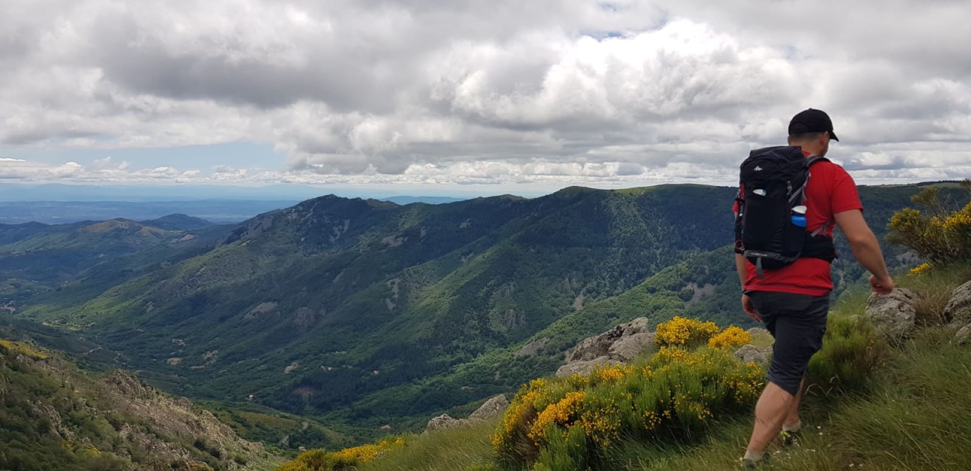
Discover the breathtaking panorama of the Rocher d'Abraham, from the village of Mayres in the Ardèche valley, following the trail of the Giant’s Causeway. Quite technical ridge paths due to the terrain, for insiders!
🔁Loop ⚠5 Very difficult 🕒7H 📏14km 📈+978m 📉-978m ![]() PR
PR
Departure from the “INFO RANDO” sign, church square in Mayres.
①🚩Follow the sign: Col d’Abraham / La Souche. After the cemetery, take the path that climbs into the chestnut grove. Cross the footbridge over the Passadou stream.
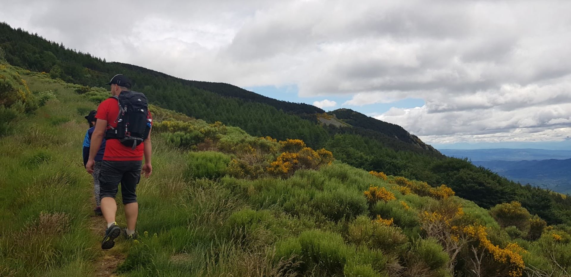
②🚩You are at le Passadou: follow the sign Col d’Abraham 2.7km / La Souche. Continue climbing through the beech forest where you can see the Rocher de l’Aigle. Cross the track and climb to the pass.
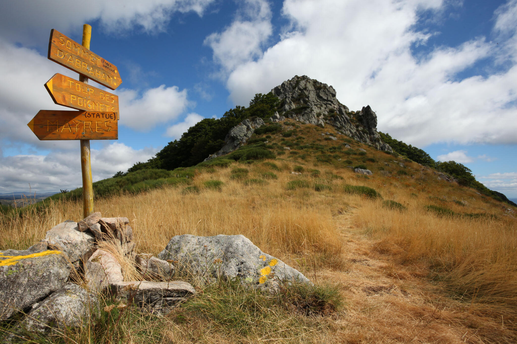
③🚩You are at Col d’Abraham: follow the sign Rocher de Taillades 4.7km / Mayres. On the right, follow the sentier des gardes, used by foresters in the past. Beware of the no-entry sign for the permanent Trail de la Chaussée des géants.
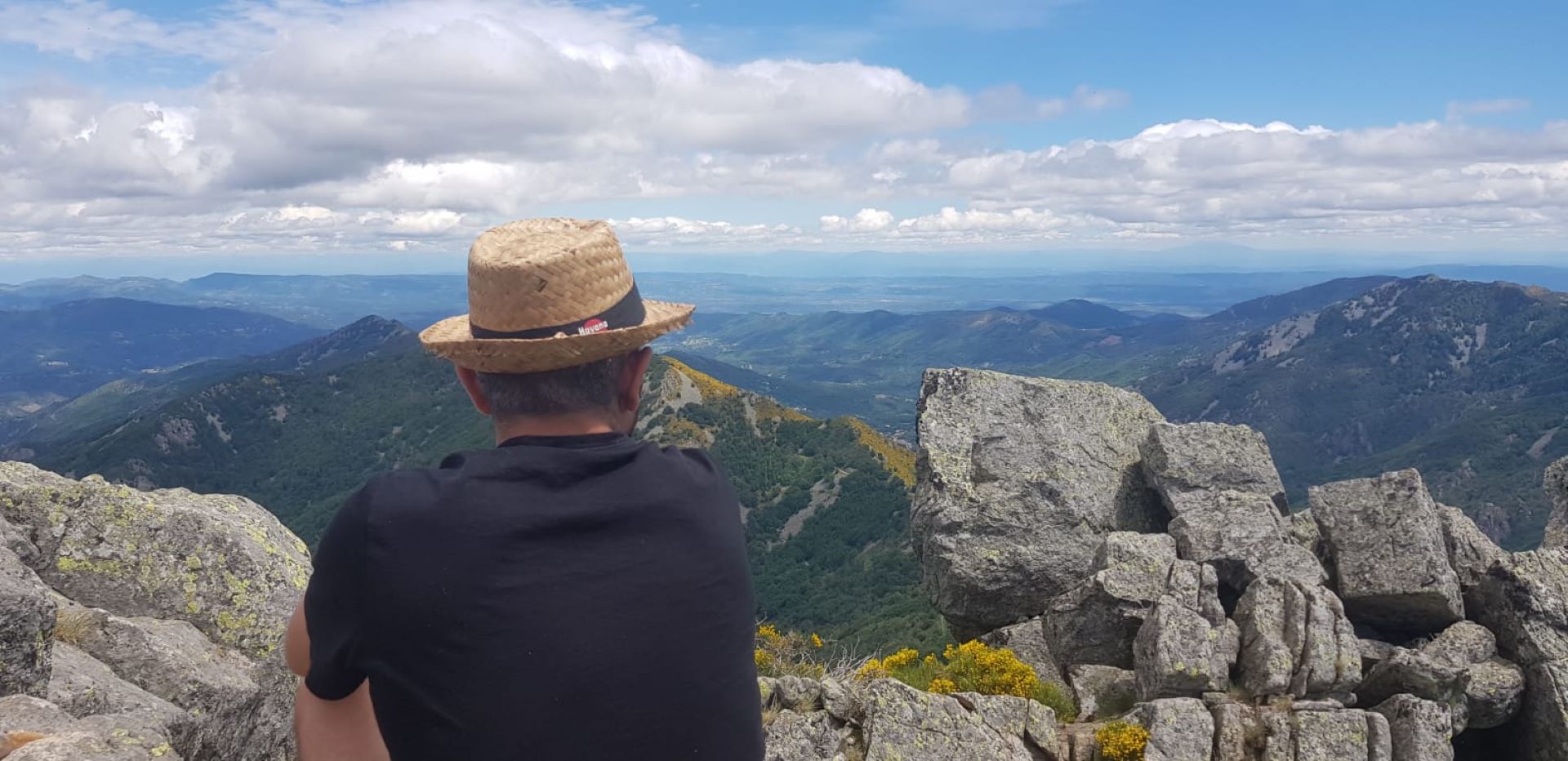
④To reach the summit of Rocher d’Abraham (1498m), leave the sentier des gardes and take the part marked by three yellow dots to the left. The trail includes rocky and steep sections, not recommended for beginners. In addition to a 360° view, you will discover the metal sculpture by Pierre Louis Chipon in honor of Jean Gilly, a great Ardèche sportsman and defender of outdoor activities and the Ardèche mountains. Alternatively, continue on the sentier des gardes along the mountainside to the Col de Mendras.
⑤You are at the Col de Mendras. Then take the ridge path to the right.
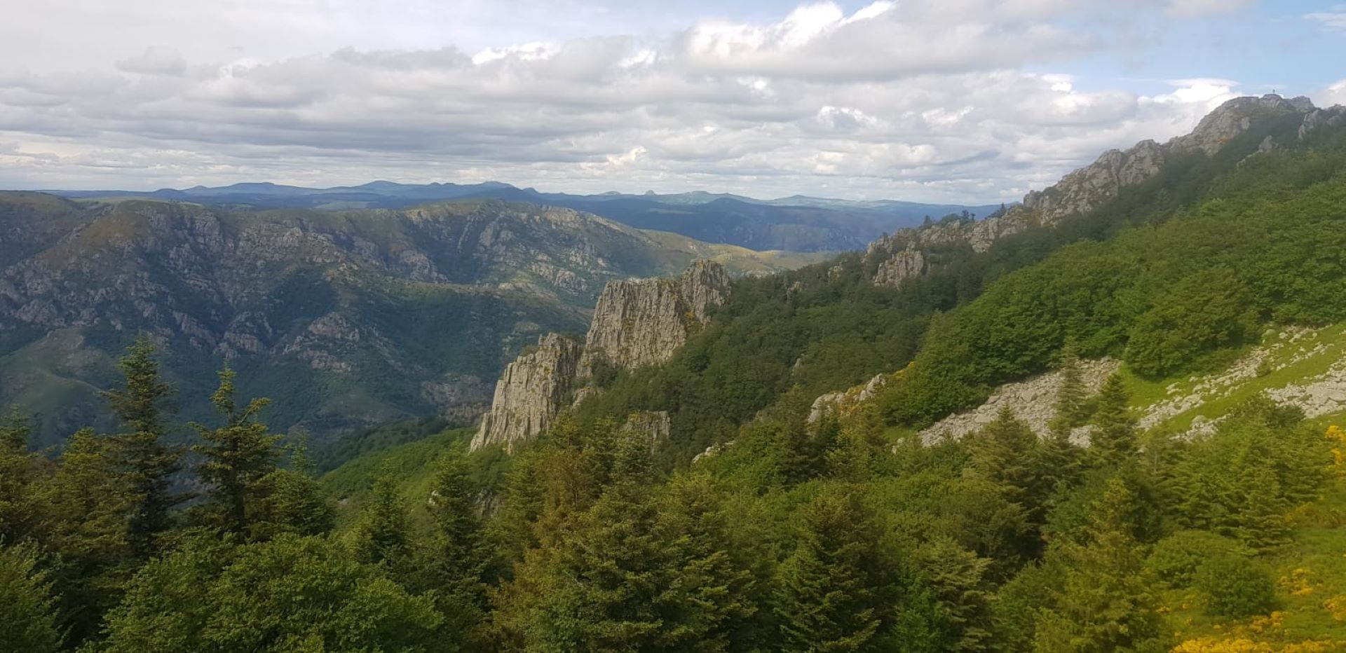
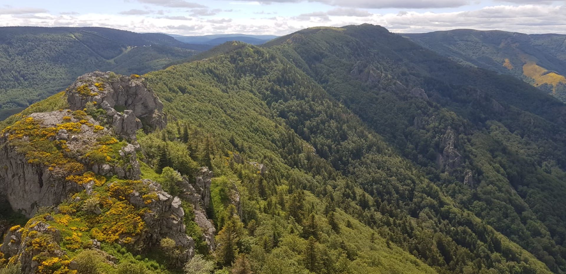
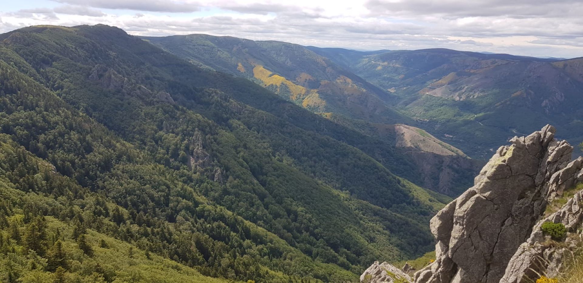
⑥🚩You are at le Fautouras: follow the sign Rocher des Taillades 2km / Mayres 9.1km. Follow the markings along the ridge path. At the Tour des Poignets, enjoy a superb panoramic view of the Monts Lozère, the Massif du Tanargue, and the Rhône valley. On clear days, you can see Mont Ventoux, Mont Gerbier de Jonc, Mézenc, and Mont Blanc.
⑦🚩You are at Rocher des Taillades: follow the sign Mayres via la Cesse 7.1km. A quick descent through the beech forest along the winding path to the Passadou stream.
⑧🚩You are at le Passadou: follow the sign Mayres 2.3km. Follow the same path back to the church square.
Alternative from Rocher des Taillades:
🚩Take the direction “Mayres via Bois de Pergeyres 8.4km”.
🚩At Cautet follow the sign “Mayres” and take the path along the Ardèche river, then descend through the beech woods. Cross the village of Mayres to return to the starting point. Allow an additional 45 minutes.
Start: Church square
Finish: Church square
Towns crossed: Mayres and La Souche
Road access and parking
From Aubenas, take the N102 towards Thueyts, then Le col de la Chavade.
Parking: Church square
🛈 Find here all the hikes in our area and on the Application Rando Monts d’Ardèche
- Car park
- Parking
- Pets welcome
- Pets accepted: Yes
- Animal reception conditions:
Please keep your pets on a leash during your hikes.
- Not accessible in a wheelchair
- English
- French
Hiking : Abraham rock in Mayres
Place de l'église
07330 Mayres


