
Hike from the village of La Souche to Mont Aigu, Ardèche
Opening : All year round.
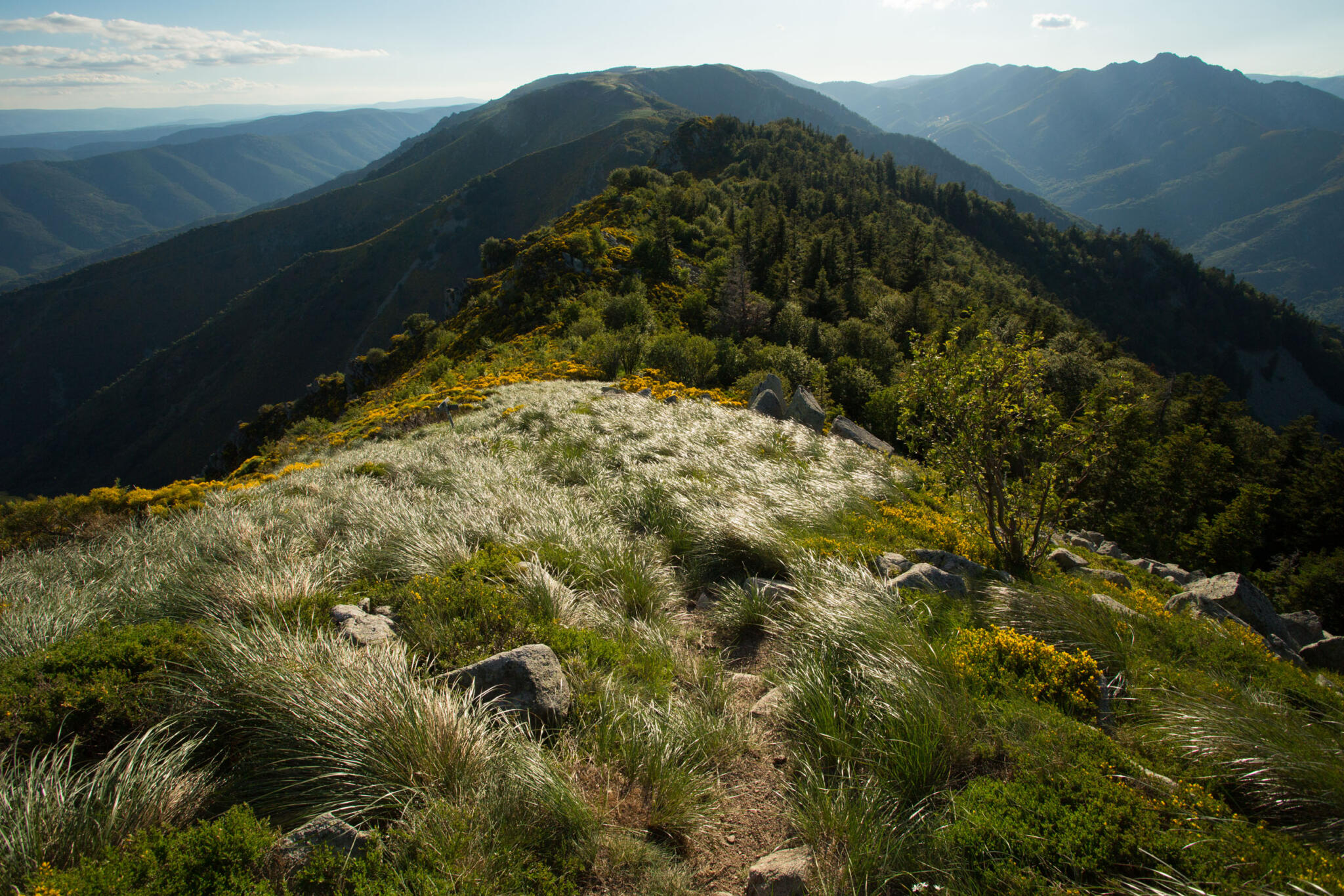
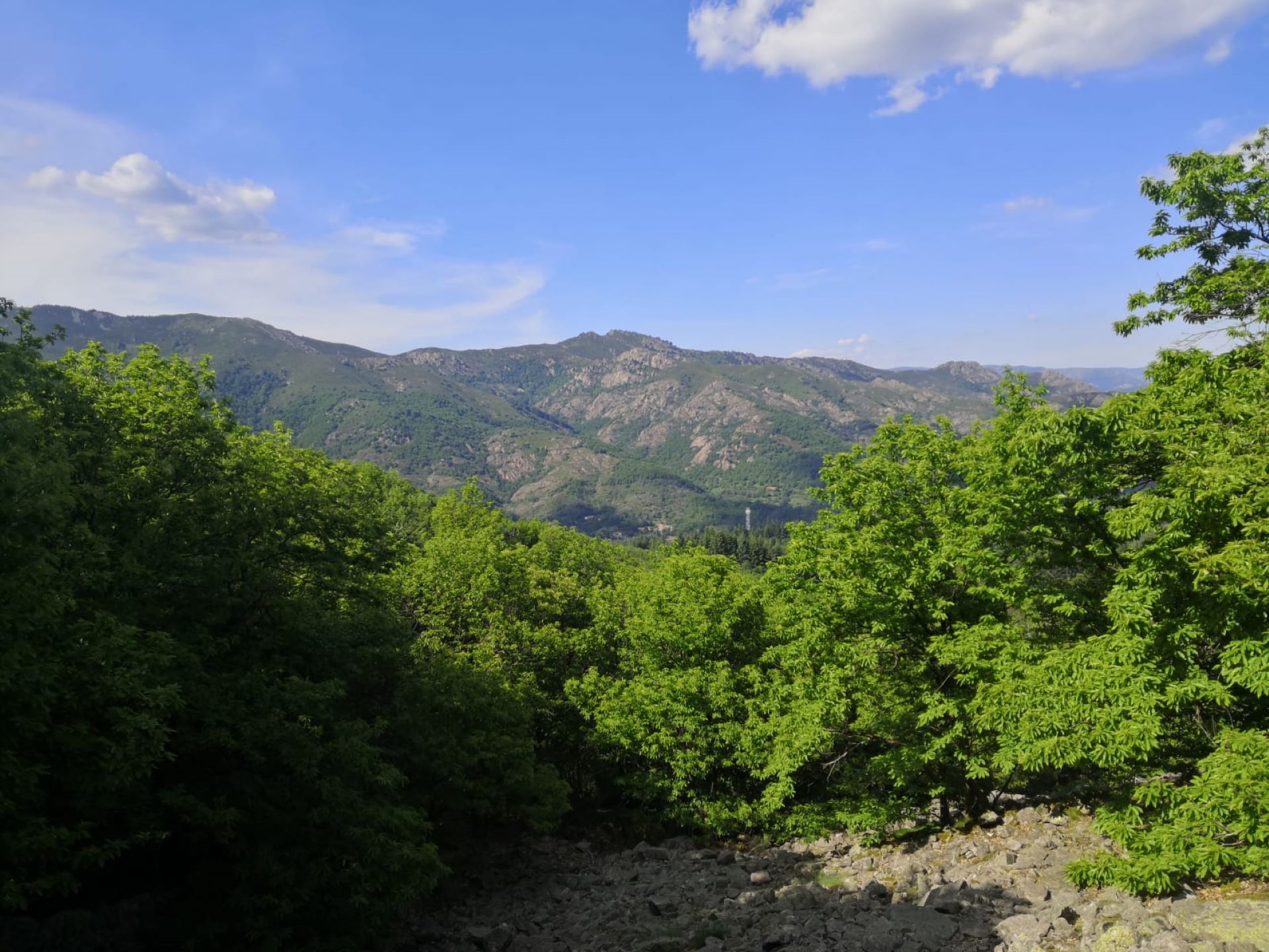
Discover the panoramic views of the Tanargue from Mont Aigu. Pass through clapas and chestnut groves before reaching the summit and its panoramic view of the Ardèche mountains and even the Alps on a clear day!
Loop / Difficult / 5 h / 9.2 km
Along the way, you'll climb the Chemin des Gardes, once used by foresters to access the Tanargue, cross the clapas (long piles of stones) and chestnut groves and follow a section of the GR de Pays du Tour du Tanargue. Once at the summit, you'll enjoy panoramic views of the Ardèche mountains, the Cévennes massif, Mont Ventoux, Mont Lozère...
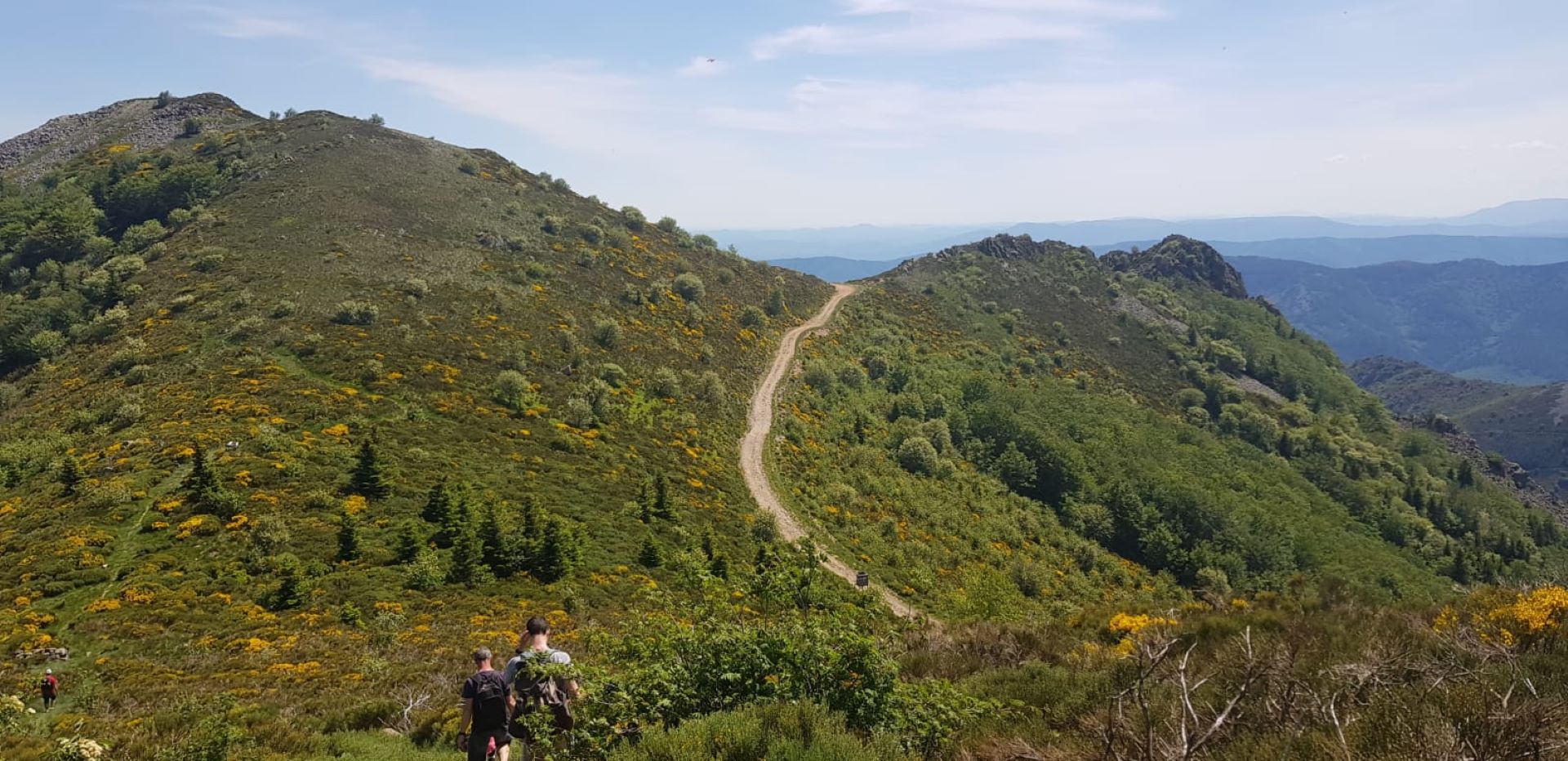
On the way down, there are superb views of Jaujac and the volcano crater, the Lignon valley, the Coiron massif and the L'Escrinet pass.
Along the walk, you will climb the Chemin des gardes, formerly used by foresters to access the Tanargue, cross the clapas (long piles of stones) and chestnut groves, and follow a section of the GR de pays du tour du Tanargue. Once at the top, there is a panoramic view of the Ardèche mountains, the Cévennes massif, Mont Ventoux, Mont Lozère… On the way down, you will have a superb panorama of Jaujac and the volcano crater, the Lignon valley, the Coiron massif, and the Col de L’Escrinet.
🔁Loop ⚠5 Very difficult 🕒5H 📏9.2km 📈+729m 📉-732m ![]() PR
PR
Start at the “INFO RANDO” panel, Place Jean Moulin in La Souche.
① Climb from Place Jean Moulin, turn right onto the main street until Pont Morand.
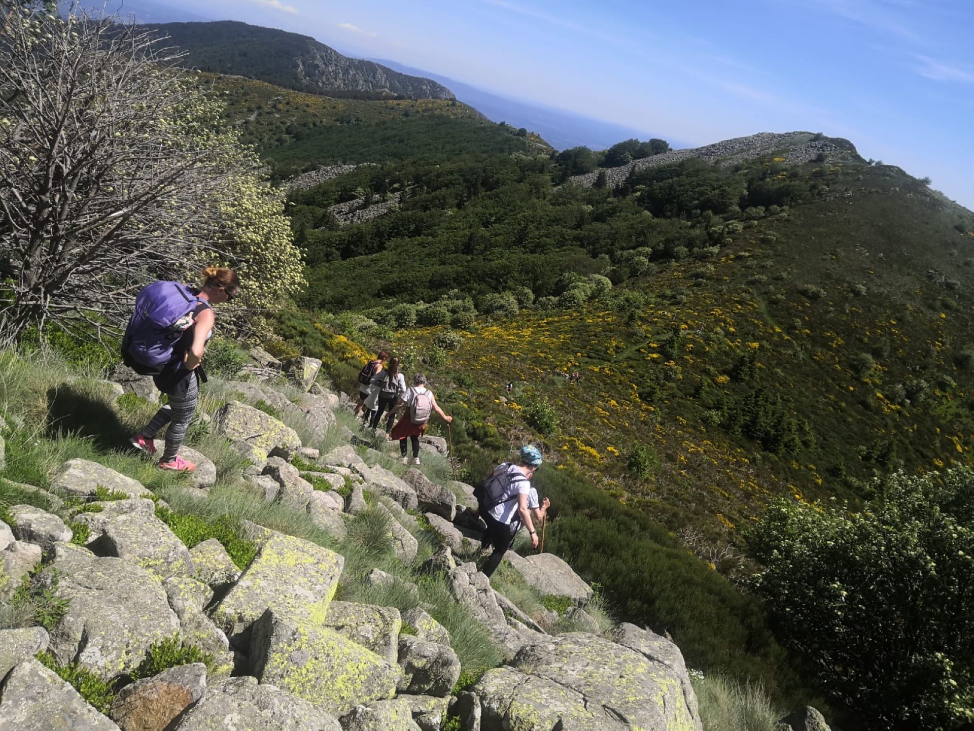
② Pass the bridge, continue on the road for 50m, and at the post 🚩 follow “Loubaresse, 19.9 km”. Climb the Chemin des gardes, formerly used by foresters to access the Tanargue. Cross the chestnut grove and then the Aiguebonne stream by a ford (Attention, impassable after heavy rain). The chestnut trees soon give way to beech trees among which the path winds. Cross the clapas (long piles of stones) to reach the bénitier (a small curved rock where rainwater collects).
③ You are at Bournatas (Difficult Variant): follow the sign to Sommet Mont Aigu. Otherwise, continue on the path to the post at Col des Langoustines.
④ You are at Col des Langoustines, turn left towards 🚩 “La Souche, 5.5km”.
⑤ At the sign 🚩 “col du Sucheyre”, turn left to reach the summit of Mont Aigu, with a panoramic view (360°) of the Ardèche mountains, the Cévennes massif, Mont Ventoux, Mont Lozère, and even the Alps on a clear day. To continue the walk, retrace your steps to the intersection. Then take the path on your left to the post at La Grange.
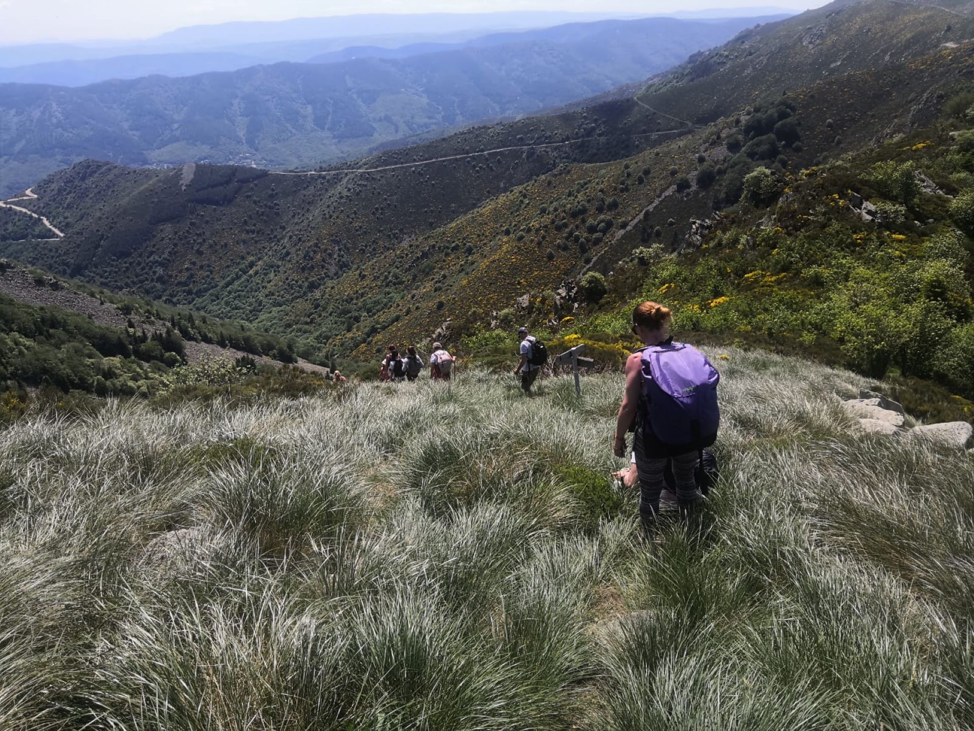
⑥ At the sign 🚩 “La Grange”. For a variant, follow Rocles 18.7km: Climb the path to the right, pass under the cable used in the past to lower hay to the village, and reach the Pointe de Rodes. Otherwise, continue on the path towards La Souche, crossing the clapas on the paved path.
⑦ At the sign 🚩 “les Plantades”, follow La Souche 1.8km. Descend the draille (path) through the chestnut trees.
⑧ You are at the post 🚩 “Les Quatre Chemins”: follow the sign 🚩 “La Souche, 1.3km”.
⑨ Cross the hamlet of La Rabeyriol and continue on the road to the left for 100m to return to the village.
⑩ Take the path to the right, then after 50m take the right path that descends to the village and your starting point.
Start/End: Place Jean Moulin in La Souche.
Communes crossed: La Souche and Laboule.
Road access and parking
From Aubenas, take the N102 to Lalevade d’Ardèche, then left onto the D19 towards Jaujac and continue for 4km towards Croix de Bauzon. From the east or north, take the D5 after Neyrac-les-Bains from the N102. Continue to Jaujac and head towards Croix de Bauzon.
Parking: In the village center at Jean Moulin parking lot
🛈 Find here all the hikes in our area and on the Application Rando Monts d’Ardèche
- Car park
- Parking
- Pets welcome
- Pets accepted: Yes
- Animal reception conditions:
Please keep your pets on a lead when out walking.
- Not accessible in a wheelchair
- English
- French
Hiking : Mont Aigu circuit in La Souche
Place Jean Moulin
07380 La Souche


