Quick and easy hike to the Ray Pic waterfall at Péreyres in Ardèche
Opening : All year round.
This simple out-and-back itinerary will allow you to quickly access several wooden pontoons to admire the majestic Ray-Pic waterfall, a must-see volcanic site in the Ardèche! Forest trail with several steps for access.
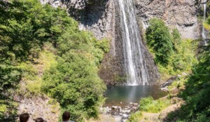
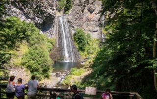
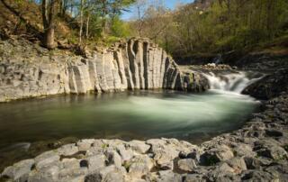
The impression left by the main jump of the Ray-Pic waterfall is striking. The water, rising forty-five meters high, seems to be accompanied by the movement of a shower of basalt, like a second cascade of hexagonal rock blocks. To the black colour of the stone meets the white of the foam. This splendid site shelters one of the rare waterfalls of the Ardèche that flow all year round. Two belvederes overlook the waterfall, allowing you to discover it from every angle. The geological history of the formation of these basaltic organs is equally astonishing. It is the story of an extinct volcano and a rising waterfall… You will discover this history in the interpretation area, at the start of the access path to the two belvederes. It will reveal that the basalt flow of the Ray-Pic volcano is one of the longest in Europe: 21 km from Pont-de-Labaume! If you feel like it, you can also spot along the Fontaulière and Bourges the basalt organs that dress it in black in places. To follow them is to go back in time.
Departure/Arrival: Reception area of Ray-Pic, parking access to the waterfall on the D215 in Péreyres, the trail leaves behind the presentation space of the site.
Attention, swimming is strictly forbidden at the Cascade du Ray Pic.
~~~~~~~~~~~~~~~~~~~~~~~
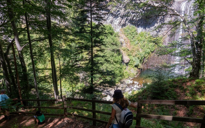
The trail, very well marked and secure, will make you walk through 3 lookouts offering breathtaking views of the gorge and the waterfall.
Start by taking the path that starts on the right at the end of the reception area.
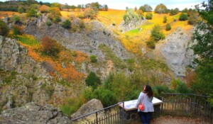
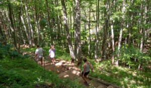
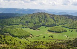
➤ After a short climb, a first wide view of the Fialouse section allows you to understand the site (belvedere of the Rock). Take the path that then begins to descend into a wood towards the waterfall. You will have several steps to climb and then descend.
➤ You then have the choice between the belvedere of the waterfall (straight) that will bring you higher and in profile compared to the waterfall or the belvedere of the gorge, on your left, which will make you descend lower but will offer you a more global view of the site and the main waterfall of the Ray Pic.
We recommend that you do so. When you get to the last lookout, retrace your steps.
↔ Round trip ⚠2 Easy 🕒45″ 📏1.5km 📈+49m PR
Departure from the Ray Pic waterfall reception area on the D215 after the village of Péreyres in Ardèche. Please note that swimming is strictly prohibited at the Ray Pic waterfall.
The well-marked, safe path takes you past 3 lookouts offering uninterrupted views of the gorge and waterfall.
① 🚩Start by taking the path that goes off to the right at the end of the reception area.
② After a short climb, an initial wide viewpoint overlooking the Fialouse cut allows you to take in the site (belvédère de la Roche). Return to the path, which then begins to descend into a wood towards the waterfall.You will have several steps to climb up and then down (be careful, they are not all level).
③ You can then choose between the waterfall lookout (straight ahead), which will take you higher up and in profile to the waterfall, or the gorge lookout, on your left, which will take you lower down but give you a more comprehensive view of the site. We recommend you do it this way. When you reach the last viewpoint, retrace your steps.
Start/Finish point: Ray-Pic waterfall reception area on the D215 after the village of Péreyres in Ardèche.
Towns crossed : Péreyres
Road access and car parking
From Aubenas, take the N102 road towards Le Puy en Velay, then follow the D536 towards the village of Péreyres/Cascade du Ray Pic. After the village of Péreyres, continue along the main D215 road to the Cascade du Ray Pic car park. Please note that swimming is strictly prohibited at the Cascade du Ray Pic.
Parking : Above or below the Ray Pic reception area on the D215, Péreyres. It is forbidden to park in front of the site in the space reserved for the disabled.
🛈 Find out about all the hikings in our region here and on the Monts d’Ardèche Hiking App Rando Monts d’Ardèche
Host portrait
«The waterfalls of the Ray Pic» is a volcanic natural site classified since 1931, where the water of the Bourges springs in the middle of basalt flows. Then, it flows about fifty meters high, from the top of a thick basalt formation that forms a superb prismation in sheaf. The only flow of the volcano travelled 21 km along the Bourges and Fontaulière.
Sustainable tourism
⚠ Do not leave traces of your passage ⚠ Take only the trails. ⚠ Don’t pick anything. ⚠ Learn about protected flower species. ⚠ Be careful not to disturb wild animals and control your pets. ⚠ No fire, no incandescent butts. ⚠ Respect the water: it is the common good of all:men, animals and plants
- Car park
- Parking
- Pets welcome
- Pets accepted: Yes
- Animal reception conditions:
Please keep your pets on a leash during your hikes.
- Not accessible in a wheelchair
- English
- French
Hiking: Easy access to the Ray Pic Waterfall
Parking d'accès à la Cascade du Ray Pic
D215
07450 Péreyres
