Hiking : Around Lalevade old Mines
Parking de la mairie
07380 Lalevade-d'Ardèche
Walk around the Lalevade mines in Ardèche
Opening : All year round.
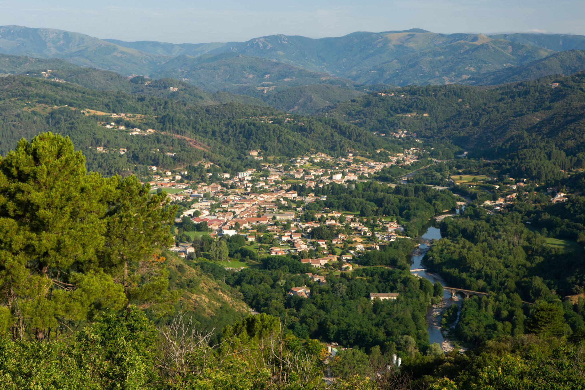
An easy walk for all the family, where you can see the mining concession marker that bears witness to industrial activity, as well as viewpoints over the Salindre and Ardèche valleys.
Loop / Level: Easy / 2 h / 5.2 km
🔁Loop ⚠2 Easy 🕒2H 📏5.1km 📈+195m 📉-194m ![]() PR
PR
Starting point: Town hall square in Lalevade d’Ardèche.
① Go up the street and turn left towards Rue des Écoles until you reach the stadium.
② Go up the street along the stadium, passing by the fire station.
③ Shortly after, leave the road and take the path on the left that goes through pine trees and then chestnut trees. You will see a beautiful panoramic view of the Salyndre valley and the village of Prades. Continue up the path to the Martinesche hiking signpost.
④ 🚩 You are at Martinesche, follow the path to the right. Continue the path to reach the hamlet of Terrisses.
⑤ Cross it to the left and take the path to the right. Pass by the cemetery.
⑥ At the intersection with Rue des Écoles, turn right. Pass by the church and return to the starting point.
Start: Town hall square
End: Town hall square
Towns crossed: Lalevade d’Ardèche and Prades.
During your walk, you will pass near the “Via Ardèche” greenway cycling route and its La Clape beach, an ideal swimming spot for everyone.
Road access:
Aubenas, take the N102 to Lalevade d’Ardèche.
Thueyts, take the N102, cross Pont-de-Labeaume, then Lalevade d’Ardèche.
Parking: Town hall square
🛈 Find here all the hikes in our area and on the Rando Monts d’Ardèche app
- Car park
- Parking
- Pets accepted: Unknown
- Pets allowed (supplementary payment): Unknown
- Not accessible in a wheelchair
- French


